Human verified. Last updated by our editorial team on .
South America · Andean states before the conquest
Cuzco
c. 1200–1438
Cuzco was the highland town and its surrounding valley that, for something like two centuries before the Inca Empire, was one chiefdom among several in the southern Peruvian Andes. It sat at about 3,400 metres, where two small rivers met, in a basin that could grow maize on the valley floor and potatoes and quinoa on the slopes above. Its people spoke Quechua, herded llamas and alpacas, cut irrigation channels, and fought their neighbours. Then, within a few generations, they conquered most of the Andes.
- Existed
- c. 1200–1438
- Shown on the map
- 1294–1439
- Peak area
- 9k km²
- Region
- South America
The conventional account gives this polity the years 1200 to 1438 and calls it the kingdom of Cuzco. The dates come from a modern reconstruction, not from any Inca record; the word kingdom is a translation of a Spanish word for a lordship. Neither is exactly wrong, but both are conveniences, and this entry treats them as such. What can be said with confidence is that a ranked, sacral lordship based on the Cuzco valley turned into an expansionist state in the fifteenth century, and that the turning point was a war against the Chanca people, conventionally dated to 1438.
That date is the reason this entry exists. Everything before it is the subject here; everything after belongs to the Inca Empire. The distinction is not merely bookkeeping. The institutions that made the empire possible — the kinship corporation that maintained a dead king's estate, the labour levy, the resettlement of conquered populations, the imperial pottery style — either did not exist before 1438 or existed only in embryo. The kingdom of Cuzco was not a small version of the empire. It was a different kind of polity that happened to sit on the same ground.
At a glance
| Name | Cuzco (Quechua Qusqu; colonial Spanish "Cuzco", modern Peruvian "Cusco") |
| Dates | c. 1200–1438 by the conventional chronology; drawn on this map 1294–1439 |
| Where | The Cuzco basin and the upper Vilcanota drainage, southern Peruvian highlands, at c. 3,400 m |
| Capital | Cuzco itself, at the confluence of the Huatanay and Tullumayu |
| Government | A paramount lord (later called Sapa Inca) drawn from the Hanan Cuzco lineages, ruling through kinship corporations and reciprocal obligation rather than through a bureaucracy |
| Population | Unknown; the Cuzco basin has roughly 220 recorded late pre-imperial sites against some 850 of Inca date |
| Economy | Irrigated maize in the valley, tubers and herding on the puna, terraced slopes, textile and ceramic production, tribute and raid |
| Language | Quechua, with local variants; no writing system, but knotted-cord records |
| End | Absorbed into the empire after the Chanca war of 1438; the empire in turn fell to Castilian invasion in 1533 |
Where did the Inca say they came from?
The Inca left no written history, so the earliest accounts of their origins are colonial. Three of them matter, and they disagree with each other in ways that are instructive.
Pedro Sarmiento de Gamboa wrote his History of the Incas at Cuzco in 1572, on the orders of the viceroy Francisco de Toledo, taking testimony from Inca elders. In his version, four brothers and four sisters came out of three windows in a rock at Tambotoco, a place south of Cuzco also called Pacariqtambo, "the lodging of the dawn". One brother, Ayar Cachi, was lured back into the cave and sealed in; another, Ayar Uchu, was turned to stone at the hill of Huanacauri and became the most venerated shrine in the country; a third, Ayar Auca, flew to a heap of stones on the site of Cuzco, sat on it, and was petrified there as the act of taking possession. From the heap — cozco in the old language of the valley, Sarmiento says — the place took its name. Only Manco Capac was left, with his sisters, to settle.
The Inca Garcilaso de la Vega, writing in Spain in 1609, told a different story. The Sun, seeing humanity living like beasts, sent a son and a daughter up from Lake Titicaca with a golden sceptre; where the sceptre sank into the ground they were to found a city, and it sank at Huanacauri, near Cuzco. Their mission was to teach agriculture, weaving, house-building and law. This is a civilising myth, and it is unmistakably shaped by a Christian and classical education and by Garcilaso's wish to present his mother's people as founders of a legitimate civilisation.
Pedro Cieza de León, writing in 1553 and drawing on testimony taken in Cuzco, gave a third version in which nothing is taken by force: Manco Capac found existing Indians in the valley in large numbers, "did them no harm and did not in any wise molest them", and they "rejoiced at his coming". He built a small stone house with a straw roof, which he called Curicancha, the place of gold, and this was the origin of the great temple of the Sun.
The three accounts agree on the outline — a migrant group from somewhere to the south takes the valley and its leader becomes the ancestor of a ruling line — and disagree about everything that matters. What they are is charters. Each answers a question about legitimacy: why this lineage rules, why this city is the centre, why the Inca are owed obedience. María Rostworowski pointed out that the names of the Ayar brothers can be read as cultigens: cachi is salt, uchu is chilli, maca is a high-altitude root, and ayar may be wild quinoa. On that reading the origin story encodes the food plants of the highlands and the adaptation of a herding and farming people to the puna, as much as it encodes a genealogy.
What does the ground say about the first Cuzco?
Archaeology gives a different kind of origin story, and a slower one. The Cuzco valley has been occupied since the Late Formative, roughly 800 BC to AD 300, and its ceramic sequence runs through the Early Intermediate Period and the Middle Horizon without a break. The site of Ak'awillay, 20 km west of Cuzco, was settled around 200 BC and grew to at least 10 hectares. Cuzco was not a virgin site waiting for a founder.
From about AD 600 the valley came within the orbit of the Wari state, whose great administrative centre at Pikillacta sits in the Lucre basin a short distance south-east of Cuzco. Wari influence is visible in a local pottery style called Arahuay — broad red bands outlined in narrow black lines over a buff slip — which imitated Wari pottery from Ayacucho but was made from local clays. Radiocarbon dates on Arahuay contexts at Pukacancha and Tankarpata run between about 1100 and 1320 uncalibrated years before present, which places the style in the Middle Horizon.
When Wari collapsed around AD 1000, Pikillacta was abandoned, and out of the Arahuay tradition came Killke, the pottery of the Cuzco valley in the Late Intermediate Period. Killke shares the diagnostic red bands but is locally made and locally idiosyncratic. For decades, following John Rowe, archaeologists treated Killke as the pottery of the pre-imperial Inca, largely on the strength of stratigraphy at Sacsayhuamán where Killke sherds lay beneath Inca ones. That equation is now handled more cautiously. A pottery style is not a people, and Killke vessels are found at sites belonging to groups the Inca later fought.
What the surveys show is a landscape of many small polities. Regional projects have registered roughly 1,000 Late Intermediate Period sites in the Cuzco area, including some 220 in the Cuzco basin alone, most of them small villages on ridges and hillsides. The largest reach 50 hectares or more. The chronicles give names to some of these groups — the Ayarmaca, the Pinagua, the Mohina, the Cuyo, the Quilliscachi, the Mayo, the Sanco, the Anta, the Hualla, the Alcabisa — and the archaeology fits the names: a decentralised field of agropastoral communities, some of them substantial, none of them dominant.
The climate helped shape this. Sediment cores from Lake Huaypo, a few kilometres from Cuzco, indicate an arid phase from about 1100 to 600 years before present, which would have pushed communities towards mixed herding and rain-fed farming on the hillsides rather than dependence on valley-floor maize. The Cuzco that the Inca inherited was a scatter of such communities, not a vacant valley or a single kingdom.
Did Manco Capac found a kingdom?
The most detailed account of the founding, Sarmiento's, is not a story about pious settlement. It is a story about land and water.
Manco Capac and his sisters came down into the valley and stopped at a place called Matahua, where they built huts. His sister Mama Huaco took two wands of gold and hurled them to test the soil: one fell into loose, unterraced ground at Colcapampa and did not stick; the other fixed itself at Huanay-pata, near where the road to the Collao later ran, and there the land was fertile. They went to take it. The ground was already occupied by a people called the Hualla, and the Inca accounts, as Sarmiento recorded them, do not soften what followed: Manco Capac and Mama Occlo settled "against the will of the Huallas", and Mama Occlo is said to have killed a Hualla man, cut out his heart and lungs, and carried them in her mouth to terrify the rest. A chief called Copalimayta came out to resist the newcomers and initially drove them back; on a second attack the Inca captured him and he fled. His houses, lands and people were taken.
The same chapter describes the founding of the city: Manco Capac, Mama Huaco, Sinchi Roca and Manco Sapaca settled between the two rivers and built the House of the Sun, which they called Ynti-cancha, on the site later occupied by the Coricancha and then by the monastery of Santo Domingo. They divided the ground into four quarters — Quinti-cancha, Chumpi-cancha, Sayri-cancha and Yarampuy-cancha — and parcelled out the sites among themselves. Then they dealt with the Alcabisa, who lived near where Santa Clara now stands. When the Alcabisa set boundary markers around the fields they had been left, Mama Huaco proposed cutting off their water instead, and the Inca did so until the Alcabisa gave up the rest of their land.
Cieza's version of the same events has Manco Capac harming nobody and being welcomed. Both writers were working from Cuzco testimony twenty to forty years after the conquest, and both had reasons to shape it. Markham, translating Sarmiento in 1907, put the problem plainly in his introduction: Toledo used Sarmiento's narrative to answer Las Casas, arguing that the King of Spain was rightful sovereign of Peru because the Incas had themselves usurped power by conquest and ruled as tyrants. Hence, Markham wrote, the constant repetition of "cruel tyranny" and "usurping tyrant", and the viceroy's own interpolations, which he italicised in the manuscript. The hostile portrait is a brief. So is Garcilaso's idyll. The honest conclusion is not that the Inca were conquerors rather than civilisers, or the reverse, but that the earliest layer of Cuzco tradition described the taking of land and water by force, in a valley where that was how land was held.
Who were the kings, and can their dates be trusted?
The conventional list has thirteen rulers from Manco Capac to Atahualpa, of whom eight — Manco Capac, Sinchi Roca, Lloque Yupanqui, Mayta Capac, Capac Yupanqui, Inca Roca, Yahuar Huacac and Viracocha — belong to the pre-imperial period. The ninth, Pachacuti, is the conqueror. Almost every element of that list is contested, beginning with whether all of the first eight existed.
The dates are a twentieth-century construction. Before the 1940s, estimates for the Inca dynasty's length varied wildly, because the chronicles themselves give impossible figures. Sarmiento has Manco Capac dying in the year AD 665; Sinchi Roca living 127 years and succeeding at 108; Lloque Yupanqui dying in AD 786, which would give him a reign of more than a century after his father's death in AD 675; Capac Yupanqui ruling 89 years and dying in AD 980; Inca Roca dying in AD 1088. Read literally, Sarmiento's sequence puts the first Inca in the seventh century and stretches the eight pre-imperial reigns across four hundred years.
John Rowe's reconstruction, published in 1944 and 1945, cut through this by trusting one source selectively. He took the dates in Miguel Cabello Balboa's chronicle of 1586 for the last emperors, where they can be checked against the Spanish invasion, and rejected Cabello's dates for the earlier ones as incredible. He then compressed the list so that the dynasty began around 1200 and the imperial phase began in 1438. That is where the figure in every reference book comes from: not from an Inca record, not from a chronicle, but from a decision about which chronicle to believe and how much to shorten.
The objections are serious. Brian Bauer argued in 1992 that there is no evidence the Inca or any other Andean group counted years, so there is no way to know whether Cabello Balboa had an indigenous source for his dates or invented plausible ones; on the pottery evidence Bauer proposed about 1400 as a better date for the beginning of the Inca period in the Cuzco region. R. Tom Zuidema went further and read the whole king-list as a structure rather than a chronicle — a diagram of moieties, lineages and ceremonial order projected onto time. On that reading the list is not a sequence of reigns but a map of relationships, and the "kings" are positions in a system.
The list does have a suspicious symmetry. The royal lineages, the panacas, are listed as five for Hurin Cuzco, the lower half, and six for Hanan Cuzco, the upper half; other sources name further panacas, which would bring each half to eight — a doubling that Rostworowski noted is characteristic of Andean dual organisation. Inca Roca, the sixth ruler, is credited with founding the Hanan moiety and moving his residence out of the House of the Sun. The point at which the dynasty splits in half is also the point at which the archaeology begins to show something like a dominant lineage in the basin.
None of this means the kings were inventions. It means the list is a genealogy of legitimate lineages, arranged to make a political order look like a succession, and that its dates are a modern convenience.
How did the early Inca fight their neighbours?
The pre-imperial reigns, as the chronicles tell them, are a record of small wars fought at short range, repeatedly, without decisive result.
Capac Yupanqui, the fifth ruler, is credited with being the first to campaign beyond the valley: he subdued Cuyumarca and Ancasmarca, four leagues from Cuzco, and took a daughter of the lord of Ayarmaca as a wife — an alliance dressed as a conquest, since the Ayarmaca were the strongest group in the region. Inca Roca, the sixth, conquered Muyna and Pinahua to the south-south-east, killed their lords, and took their lands. His son Yahuar Huacac was kidnapped as a child by the Ayarmaca lord Tocay Capac, who according to Sarmiento had wanted the boy's mother for himself; the child wept tears of blood, was renamed Yahuar Huacac, "he who weeps blood", and was eventually rescued with the help of people from Anta. The feud with the Ayarmaca ran for generations.
Sarmiento, who had the advantage of interviewing people who remembered the old order, explained why these wars never settled anything. The early Inca, he wrote, "did not place garrisons in the places they subdued", so that when a ruler died the conquered towns rose again; the subjection "only lasted while the lance was over the vanquished". Mohina and Pinahua were conquered by Inca Roca, then invaded again by Yahuar Huacac, then again by Viracocha and his son. Even within Cuzco, one suburb made war on another.
Rostworowski drew the economic conclusion: the wars of the early reigns were probably fought for booty rather than territory, because booty was what a lord needed to be generous, and generosity was how he held allies. That is a different kind of warfare from the imperial campaigns after 1438, which aimed at permanent incorporation.
The neighbours were not decorative. The Ayarmaca held the country around the lake of Muyna and the road to Yucay, and the chronicles treat their lords Tocay Capac and Pinahua Capac as kings who preceded the Inca. The Cuyo held ridgetop villages in the upper Sacred Valley; their centre at Pukara Pantillijlla has been excavated and produced Inca-style pottery in early contexts, but no gold or shell — a group that became subordinate without becoming honorary Inca. Far to the north-west, on the coast, Chimor had given way to the Chimú Empire, the greatest power on the Andean coast before the Inca, and one that the Inca would absorb only in the 1470s.
What did the valley feed them on?
The Cuzco basin is a set of ecological steps. The valley floor, the kichwa zone, is warm enough for maize, the prestige crop of the Andes and the basis of chicha beer. Above it the suni gives potatoes, oca, quinoa and other tubers and grains that tolerate frost. Above that, the puna, is pasture for llamas and alpacas, which supplied meat, wool, and the pack animals that made highland transport possible. A community that controlled several steps could feed itself from all of them, and the Inca, based at the junction of two rivers with terraced slopes on every side, controlled a good set.
Terraces were the technology that made the slopes productive, and Cieza described them as part of the city's defences as well as its fields: from the buildings, he wrote, "run broad terraces on which they sow their crops, and they rise one above the other like walls, so that the whole slopes were formed in these andenes, which made the city stronger". Water was the other lever. Inca Roca is credited with finding the springs called Hurin-chacan and Hanan-chacan — the lower and upper waters of Cuzco — and leading them into conduits, which Sarmiento, writing in 1572, says were still irrigating fields in his day.
The herding side is easy to underestimate. The Lake Huaypo evidence for a long arid phase suggests that the centuries in which the Inca were consolidating were centuries in which mixed herding and rain-fed farming made more sense than dependence on irrigated maize. Camelid herds were also wealth: they were the animals given in marriage gifts and sacrificed at shrines, and the wealth in a lord's hands was counted partly in them.
Long-distance goods moved through this economy too, though in small quantities before the empire. Excavations at Ak'awillay found Spondylus shell, an Ecuadorian marine shell of high ritual value, and gold in the Inca-era levels, while the earlier levels contained Wari-related pottery imported from Ayacucho. The valley was connected to networks that ran the length of the Andes long before the Inca controlled any of them.
How was power held without a state?
The basic unit of Andean society was the ayllu, a kin group that held land collectively and traced descent from a common ancestor. The Inca were organised as a set of ayllus, and the ruling lineages formed panacas: corporations descended from a king which owned his palace, maintained his mummy, ran his cult and managed his estates after his death. Sarmiento describes the rule that produced this: each Inca had his own palace, and his successor did not move into it but built his own, leaving the dead king's palace furnished, staffed and endowed with the lands and servants needed to keep it.
The effect on the city was structural. Cuzco was not laid out around a single palace and administration but accumulated as a series of royal houses, each with its own estate and its own corporation, plus the temples and the quarters of the original four canchas. The panacas were also political factions: Rostworowski notes that their alliances and enmities shaped Inca politics, and that membership could shift — Pachacuti left his natal ayllu for the Hatun Ayllu, a move she reads as evidence that a king changed corporation when he took power.
Succession was not strictly hereditary by primogeniture. Lloque Yupanqui took the lordship over an elder brother; Capac Yupanqui over Cunti Mayta, who was disinherited for having an ugly face; Viracocha after his elder brother was murdered; Pachacuti over his father's designated heir. Each succession was a contest settled by the guardian ayllus, the leading men, and sometimes by force. That is a chiefly politics, not a bureaucratic one.
And the lord's power ran through reciprocity rather than command. Rostworowski's reading of Betanzos, the earliest and most Andean of the chronicles, is that Pachacuti could not simply order his neighbours to work. He had to invite the local lords to Cuzco, feast them for days, give them cloth, coca and women of his lineage, and only then make his request — minka, "to ask someone to help me, promising something in return". His first building programme was therefore of storehouses: without goods to give, he could not be generous, and without generosity he could not get labour. This is the mechanism that the empire would later scale into the mit'a, the rotating labour levy that built Sacsayhuamán and the provincial roads.
What was missing before 1438 is equally telling: no provincial governors, no garrisons, no resettlement of conquered populations, no standardised imperial pottery, no administrative centres beyond the valley. The Inca of 1367 could call out their own ayllus and their allies' men. They could not command a province.
What did Cuzco look like in 1367?
The map year falls in the sixth of the eight pre-imperial reigns of Rowe's reconstruction: the reign of Inca Roca, the first of the Hanan line. Treat the attribution as a frame rather than a fact, since the reign dates are a modern fit to an inherited list. What can be said is that in the mid-fourteenth century the lordship was still one of several in the basin, and that the archaeology of the basin in this period shows Killke pottery, hillside villages, and at the centre a town at the top of the regional size range.
Sarmiento gives Inca Roca two achievements that fit such a town. He brought the upper and lower springs of Cuzco into conduits, which is the kind of work a growing settlement needs and which a lord with claims on labour could organise. And he moved his residence out of the House of the Sun into the upper part of the town, founding the Hanan moiety and beginning the pattern of separate royal palaces. The House of the Sun itself, the Ynti-cancha, stood where the Coricancha and later the convent of Santo Domingo stand, at the confluence of the Huatanay and the Tullumayu. Around it were the four quarters the founders laid out, each a walled compound or cancha of stone houses, and beyond them the terraced slopes.
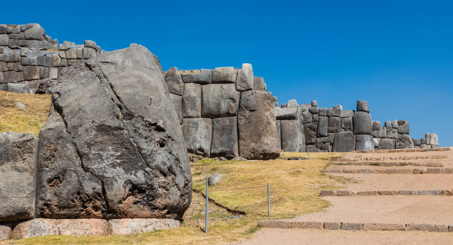
The megalithic Sacsayhuamán on the hill above the city belongs to a later phase. Cieza, who inspected it twice, says it was begun on the orders of Inca Yupanqui — Pachacuti — with 20,000 men levied from the provinces, 4,000 quarrying stone and 6,000 hauling it with leather ropes, and he measured blocks of 12 feet by 20 and more, fitted so closely "that a rial could not be put in between two of them". He also recorded the "tired stone", saycusca rumi, a block 260 of his palms in circumference that the workers abandoned on the road, and which the Indians told him had grown tired. That is a fifteenth-century building site, not a fourteenth-century one.
So the Cuzco of 1367 was a highland town of a few thousand people, with a sun temple of stone and thatch, canals, terraces, a set of royal compounds and a hinterland of maize fields and llama pastures, in a valley shared with rivals who were not yet subjects. It was not yet the city of dressed stone that the Spanish found.
Why did 1438 become the dividing line?
The story the Inca told about themselves turned on a battle. A people called the Chanca, whose country lay around Andahuaylas some 30 leagues west of Cuzco, marched on the city with two lords, Asto-huaraca and Tomay-huaraca, and an idol named Ancoallo carried before them. The old Inca Viracocha, advised by his captains, left Cuzco for a fortified place at Caquia Xaquixaguana, taking his chosen heir, Inca Urco, with him. A younger son, Cusi Inca Yupanqui, refused to go. He was, Sarmiento says, 20 or 22 years old, and he held the city with seven lords and their men while most of the population took to the hills to watch.
Before the battle he had a vision at a spring called Susurpuquio: a figure like the Sun appeared, consoled him, and held up a mirror in which he saw the provinces he would conquer. The fighting was in the streets and squares, at a suburb called Chocos-chacona, where a woman named Chanan-ccuri-coca fought like a man and drove the Chanca back. Sarmiento says that great numbers of men were seen coming down from the hills, sent by the Creator, and that the Chanca broke. Inca tradition called these pururauca, stones that turned into warriors, and the story circulated widely among their enemies. A second battle followed at Ichu-pampa, where Inca Yupanqui killed Asto-huaraca with a battleaxe and set the two Chanca lords' heads on lances. It was after this that he took the name Pachacuti, "overturner of the earth".
Cieza's version has a different politics and no miracles of that kind: the leading men of Cuzco, seeing that neither Viracocha nor Urco had made any preparation, asked Inca Yupanqui to take charge of the war, and he accepted on condition that they settle the government afterwards. Rostworowski tabulated the chroniclers and found twelve who credit the victory to Pachacuti and a smaller group, including Garcilaso, who credit Viracocha; some sources describe two wars. She also asked whether Viracocha and Pachacuti might be one person split in two by the songs, and noted that the vision of the Creator on the eve of battle, attributed now to one and now to the other, has the flavour of a cantar de gesta. From the death of Yahuar Huacac onwards, she wrote, the chroniclers' account becomes murky.
The date itself is Cabello Balboa's, adopted by Rowe. No chronicle written before the 1570s gives calendar years for these events at all. Radiocarbon has since pushed in both directions. AMS dates from burials at Machu Picchu indicate occupation from about AD 1420 to 1532, two decades earlier than the textual association with Pachacuti's accession in 1438. Bayesian models of dates from Inca sites in Ecuador and Argentina suggest a provincial Inca presence several decades before the chronicle dates. In the Cuzco region itself, Inca-style pottery appears in contexts dated between roughly 1250 and 1420 at some ridgetop villages, while large valley-bottom towns kept their non-Inca architecture until the 1460s and 1470s.
None of that abolishes 1438 as a threshold, because the change after it was real and rapid. Within a generation the Inca were redistributing land around the city, building storehouses, raising the fortress, settling colonies, and campaigning hundreds of kilometres from Cuzco. They also marked the victory in the landscape: the shrines they established at the margins of the Xaquixaguana valley, where the Chanca had camped, commemorated the places associated with Pachacuti's victory. Whatever the date, the war was the event the Inca themselves treated as the beginning.
What happened at Ollantaytambo and Pisac?
The two great monuments of the Sacred Valley are usually presented as Inca civilisation at its height, and they are — but they belong to the empire, not to the kingdom. Both are royal estates of Pachacuti, built after 1438, and they are evidence for what the imperial threshold changed rather than for what preceded it.
Pisac, 33 km from Cuzco at the entrance to the valley, is described by the Peruvian Ministry of Culture's Cusco directorate as a hacienda real of Pachacuti belonging to his panaca, citing Sarmiento de Gamboa. It is a scatter of terraced sectors, domestic compounds and isolated ceremonial buildings on a narrow ridge above the Vilcanota, with the agricultural terraces of the valley floor below. The archaeological park covers 9,063 hectares. The point of the place was not defence in the ordinary sense but the combination of maize land, a royal residence and a position commanding the road.
Ollantaytambo, further down the valley, is one of the most closely studied Inca building sites, thanks to Jean-Pierre Protzen's work. The stone came from Kachiqhata, a rockfall on the far side of the Urubamba, and Protzen found that the Inca did not cut blocks from bedrock there but selected them from the fall, dressed them minimally, and sent them down a purpose-built ramp — some eighty abandoned blocks still lie along it. The fine fitting was done at the construction site, and the tools were hammerstones rather than bronze chisels: three were found at the quarry, and the cutting marks resemble those on the unfinished obelisk at Aswan. His reading is that the complex was never completed: blocks lie part-dressed where the work stopped, and at the top of the highest ramp in the south quarry two large blocks sit on working platforms not yet connected to the ramp.
Before the empire, the valley looked different. Surveys of the upper Sacred Valley recorded 225 late pre-imperial sites and 150 of Inca date; the lower valley went from 65 to 75; the Maras district fell from 80 to 35 and Chinchero from 50 to 30. The pattern is not simple growth. Royal estates and resettlement cleared people off some land and concentrated them elsewhere. The valley's earlier centres — Yunkaray, the Ayarmaca town whose occupation ran to the mid-fifteenth century, and Pukara Pantillijlla, the Cuyo stronghold — were abandoned or subordinated. The Sacred Valley of the tourists is a monument to the decades after 1438, carved out of a landscape that had belonged to other people.
Was there ever a kingdom of Cuzco?
There was a lordship, and the word kingdom is a loan translation. The ruler's title was capac, which Cieza glosses as "the rich", and later sapa inca, "the unique lord"; the Spaniards rendered the polity as a señorío or curacazgo, a lordship or chiefdom. The border data behind this map draws it as a territory of about 9,000 square kilometres at its widest, which is a modern abstraction imposed on a polity that did not have borders in that sense.
Rostworowski put the scale bluntly: until the Chanca arrived at Carmenca, at the gates of Cuzco, the Inca lordship was neither more extensive nor more powerful than the various neighbouring ethnic groups. Each valley and hamlet had a sinchi, a war leader, for its defence, and interminable wars kept all these small lordships in a permanent state of alert. Only the Chanca, victorious over their neighbours, were steadily expanding.
What the Inca had that their neighbours did not was a claim to a particular kind of sacred authority, embodied in the sun temple at the centre of the city, in the shrine of Huanacauri, and in the mummies of dead lords whose panacas preserved their charisma. That authority was enough to make them the natural focus of a coalition when a real threat appeared. It was not enough to make them rulers of other people before 1438.
So the honest description is of a ranked, sacral chiefdom with a paramount lineage, a substantial town and a functioning apparatus of tribute and corvée within its own valley, which became a state in the space of one or two generations. The kingdom is the part before the state. Calling it a kingdom is a shorthand that flatters it slightly and obscures the interesting question, which is how a chiefdom turned into an empire so fast.
What is left, and what can we still not say?
Almost nothing of pre-imperial Cuzco survives as standing architecture, because the imperial city and then the Spanish city were built on top of it. The Coricancha's foundations are under a convent; the Inca walls that tourists photograph are fifteenth-century; the pre-imperial town is beneath the streets. This is why the archaeology of early Cuzco depends on survey and on a handful of excavated sites around the basin — Ak'awillay, Chokepukio, Yunkaray, Minaspata, Wat'a, Pukara Pantillijlla — rather than on the city itself.
The documentary record has its own limits. Everything written about the Inca was written after 1533, by men who depended on the testimony of Inca elites and who had their own cases to make. The Incas kept historical information in several genres — genealogies, life histories of rulers, lists of provinces conquered — and the Spanish writers combined them into linear narratives, which is one reason the sequence of events differs so much between accounts. Whether they kept any record of elapsed years is unknown, and that unknown is the foundation of every Inca chronology.
The gaps are specific and could in principle be closed. There is no Bayesian model for the Cuzco basin comparable to the ones built for Machu Picchu or for the provinces. There are few dated pre-imperial contexts in the city itself. The transition from Killke to imperial Inca pottery is not tightly dated anywhere. And the political history of the valley's other groups — the Ayarmaca above all — is known almost entirely from the people who defeated them.
What survives best is the story. When the Castilians came, the memory of the small kingdom was already being reorganised into a charter for a much larger one; when the Spanish Empire took the city in 1533, and when the crown of Castile set about justifying its rule, the story was reorganised again. The kingdom of Cuzco that we can describe is the residue of those reorganisations, plus what the ground will yield. It is not much, but it is enough to see a highland lordship making the transition that produced the largest empire in the pre-Columbian Americas — and to see that the transition was neither inevitable nor instantaneous.
Common myths about Cuzco
| Myth | What the evidence says |
|---|---|
| Manco Capac founded the kingdom in 1200. | No source gives that date. It is John Rowe's 1940s reconstruction, built on Cabello Balboa's 1586 chronicle; the chronicles' own figures are impossible (Sarmiento has Manco Capac dying in AD 665). |
| Cuzco means "navel of the world". | Garcilaso's gloss, from the Quechua word for navel. Sarmiento, closer to Cuzco testimony, gives "heap of stones" and, alternatively, "sad" or "fertile"; Markham glosses it as a clod of hard, unirrigated land. |
| The Inca arrived as civilisers and were welcomed. | That is Garcilaso's version, written in Spain in 1609. Sarmiento's account, taken from Inca elders at Cuzco in 1572, describes the seizure of land and water from the Hualla, Alcabisa and Sauasera, and armed resistance under Copalimayta. |
| The early Inca were a small, peaceful village. | They were one of several chiefdoms, but a warlike one: campaigns against Cuyumarca, Ancasmarca, Muyna, Pinahua and the Ayarmaca, and repeated reconquest of the same towns. |
| Cuzco was an empire in waiting, with an unbroken dynasty of thirteen kings. | Archaeologically there are no state-level markers before about 1400: no provincial centres, garrisons, resettlement or imperial pottery. The basin has some 220 late pre-imperial sites against 850 of Inca date. |
| The Chanca war of 1438 is a documented event. | It is documented only by writers working 40 or more years later, who disagree about the victor — twelve credit Pachacuti, a minority credit Viracocha — and some describe two wars. The year comes from Cabello Balboa via Rowe. |
| Pachacuti invented the Inca state from nothing. | Storehouses, the panaca system, the sun cult, terraces and canals all predate him. What changed after 1438 was scale, method and the use of conquest to fund generosity. |
| The Inca could not have built Sacsayhuamán. | Cieza inspected it twice, measured the stones, and described the labour levy; Protzen documented the quarries, ramps, hammerstones and part-dressed blocks. The "tired stone" is still on the road. |
| The Killke were the Inca. | Killke is a pottery style of the Cuzco basin in the Late Intermediate Period. Rowe equated it with the pre-imperial Inca on stratigraphic grounds; a style is not a people, and Killke pottery occurs at sites of groups the Inca later fought. |
Timeline of Cuzco
| Year | Event |
|---|---|
| c. 800 BC–AD 300 | Late Formative settlement across the Cuzco valley; Ak'awillay occupied from c. 200 BC |
| c. AD 600–1000 | Wari influence in the valley; Arahuay pottery; Pikillacta built in the Lucre basin |
| c. 1000 | Wari collapse; Pikillacta abandoned; Killke pottery emerges from the Arahuay tradition |
| c. 1000–1400 | Late Intermediate Period: some 1,000 sites in the Cuzco region, mostly hillside villages |
| c. 1200 | Traditional date for Manco Capac, fixed by Rowe in the 1940s |
| c. 1300–1400 | The Ayarmaca are the dominant group in the region, with lords Tocay Capac and Pinahua Capac |
| c. mid-fourteenth century | Inca Roca, sixth ruler: springs brought into conduits, the move to Hanan Cuzco, separate royal palaces |
| c. late fourteenth century | Yahuar Huacac: kidnapped by the Ayarmaca as a child, later at war with them |
| c. 1400 | Viracocha Inca in the traditional chronology; Bauer's date for the start of the Inca period on ceramic evidence |
| 1438 | Chanca attack on Cuzco; Inca Yupanqui takes the name Pachacuti; imperial expansion begins |
| 1438–1471 | Pachacuti's reign: land redistribution, storehouses, Sacsayhuamán, Pisac, Ollantaytambo |
| c. 1460s–1470s | Non-Inca monuments at Chokepukio and Yunkaray come to an end as the Inca reorganise the valley |
| 1471–1493 | Topa Inca; the empire reaches Ecuador in the north and Chile in the south |
| 1533 | Pizarro enters Cuzco; the empire ends, the city and its walls remain |
| 1572 | Sarmiento de Gamboa writes his history at Cuzco for Viceroy Toledo |
| 1586 | Cabello Balboa's chronicle, the source of the dates later used for the dynasty |
| 1945 | Rowe publishes the chronology that fixes 1200 and 1438 |
| 1992 | Bauer proposes c. 1400 for the start of the Inca period on ceramic evidence |
| 2021 | AMS dates put Machu Picchu's occupation at c. 1420–1532 |
| 2025 | New radiocarbon dates from Ak'awillay reshape the picture of the Cuzco hinterland |
What the map shows next
At 1439 on the map the border data still draws Cuzco as a small territory, a year past the historical threshold; the empire that replaces it is already on the map beside it. Watch what happens to that small shape between 1367 on the map and 1439: it barely moves. The growth is not territorial, it is institutional, and it becomes visible only when the Inca start building outside the valley.
The successor is the Inca Empire, from 1438 to 1533, which is where the story of Tawantinsuyu, the four quarters, belongs. Its later neighbours and successors on the map — the Spanish Empire, and eventually the Republic of Peru — inherited the city, the walls and the story.
Common questions
- What was the kingdom of Cuzco?
- A highland lordship based on the town of Cuzco and its valley, one of several competing chiefdoms in the southern Peruvian Andes, which became the nucleus of the Inca Empire after 1438.
- When did Cuzco exist?
- Conventionally 1200 to 1438, though the start date is a twentieth-century reconstruction and the archaeology suggests the decisive changes came in the early fifteenth century.
- Who founded Cuzco?
- Inca tradition credits Manco Capac, a semi-legendary figure who led a migrant group into the valley and took land from the people already living there; no contemporary record of him exists.
- Who were the Inca kings before the empire?
- Manco Capac, Sinchi Roca, Lloque Yupanqui, Mayta Capac, Capac Yupanqui, Inca Roca, Yahuar Huacac and Viracocha, whose reigns are known only from oral histories written down after the Spanish conquest.
- Why does the Inca Empire start in 1438?
- Because that is the year the chronicles attach to the Chanca war and to Pachacuti's accession, the point after which the Inca began conquering territory outside the Cuzco region.
- Was Cuzco a kingdom or a chiefdom?
- A ranked chiefdom with a sacred paramount lineage is the more accurate description; "kingdom" is a translation of the Spanish term for a native lordship and overstates its institutions.
- What was the Chanca war?
- An attack on Cuzco by the Chanca people of Andahuaylas, repelled by a younger son of the Inca who then took power as Pachacuti; the sources disagree on its details and even on who led the defence.
- What did the Inca build before the empire?
- Canals, terraces, the sun temple at Cuzco and a series of royal palaces, but nothing on the scale of the imperial works such as Sacsayhuamán, Pisac or Ollantaytambo.
- Was Manco Capac a real person?
- He cannot be shown to have existed; he functions in the sources as the ancestor who legitimises the ruling lineages, and his story survives in several incompatible versions.
- Why does the map show Cuzco from 1294 when it existed from 1200?
- The border dataset has no record of the territory before 1294, so the map draws it from that year while the text uses the historical dates.
Sources
Every source below was consulted while writing this entry.
- Sarmiento de Gamboa, Pedro. History of the Incas (1572), translated by Clements R. Markham, Hakluyt Society, 1907.
- Cieza de León, Pedro. The Second Part of the Chronicle of Peru (1553), translated by Clements R. Markham, Hakluyt Society, 1883.
- Garcilaso de la Vega, Inca. First Part of the Royal Commentaries of the Yncas (1609), translated by Clements R. Markham, Hakluyt Society, 1869.
- Rostworowski, María. Historia del Tahuantinsuyu. Lima: Instituto de Estudios Peruanos, 1988; second edition 1999.
- Covey, R. Alan, Kylie Quave, Nicole Payntar, Camille Weinberg, Hubert Quispe-Bustamante and Véronique Bélisle. "Settlement discontinuity at Ak'awillay and the development of the Inca imperial capital region." Antiquity 99 (2025): 481–499.
- Covey, R. Alan. How the Incas Built Their Heartland: State Formation and the Innovation of Imperial Strategies in the Sacred Valley, Peru. Ann Arbor: University of Michigan Press, 2006.
- Ogburn, Dennis E. "Reconceiving the Chronology of Inca Imperial Expansion." Radiocarbon 54, no. 2 (2012): 219–237.
- Burger, Richard L., Lucy C. Salazar, Jason Nesbitt, Eden Washburn and Lars Fehren-Schmitz. "New AMS dates for Machu Picchu: results and implications." Antiquity 95 (2021): 1265–1279.
- Adamska, Anna and Adam Michczyński. "Towards radiocarbon chronology of the Inca State." Boletín de la Misión Arqueológica Andina 1 (1996): 35–58.
- Bauer, Brian S. and Bradford M. Jones. Early Intermediate and Middle Horizon Ceramic Styles of the Cuzco Valley. Fieldiana Anthropology, new series 34. Chicago: Field Museum of Natural History, 2003.
- Protzen, Jean-Pierre. "Inca Quarrying and Stonecutting." Ñawpa Pacha 21 (1983): 183–214.
- Ministerio de Cultura del Perú, Dirección Desconcentrada de Cultura de Cusco. "Pisaq." Parque Arqueológico de Pisaq.
- Marsh, Erik J., Rachel Kidd, Dennis Ogburn and Víctor Durán. "Dating the Expansion of the Inca Empire: Bayesian Models from Ecuador and Argentina." Radiocarbon 59 (2017): 117–140.
Data sources for the map
- Cliopatria v0.12 (Seshat Global History Databank, CC BY 4.0).
- Historical Basemaps (GPL-3.0).
This entry was written from the sources above and last updated .
Text available under CC BY-SA 4.0: reuse it with a credit to The World Through Time and a link to this page.
Border geometry for the map itself comes from Cliopatria v0.12 (Seshat Global History Databank, CC-BY-4.0).
See Cuzco in its world
Open the atlas at 1367 and every neighbour, rival and successor is on screen with it — then drag the slider and watch what happens next.
Open the map at 1367 →